
Alain Martinez
Engineering Intern

Nyssa Becerra
Engineering Intern
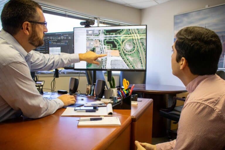
Land development engineers face a complex task that requires a unique skill set and varied tools. Understanding the interplay between the build environment and the natural world is an essential part of the land development process.
It has become paramount for land development engineers to learn and master a suite of software tools from Computer-Aided Design (CAD) to industry-specific tools like StormWise.
As with any profession, understanding the nature of the task and the mastery of one’s craft sets a great engineer apart from the layman.
In this blog, we’ll break down the key tools used by land development engineers and the utility of each software.

CAD Software
Computer-aided design (CAD) software enables most engineering tasks in land development. The software allows civil engineers to design complex site layouts, road alignments, grading plans, and drainage systems with precision.
Civil 3D
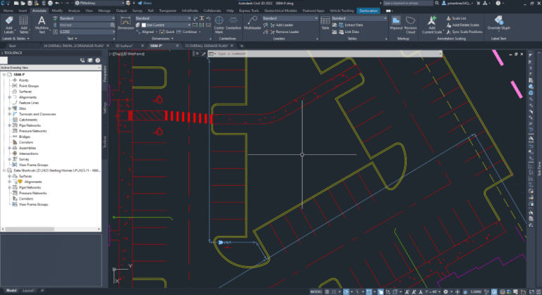
Civil 3D by Autodesk is the most useful tool for land development engineers. Civil 3D can model changes required for land development, including the placement of structures.
Its geolocation capabilities incorporate real-world mapping of features like elevation to ensure designs align with actual site conditions. It provides a realistic view of:
- Alignments
- Vertical surfaces with corridors
- Grading groups, and
- Feature lines
Being able to visualize these elements allows for precise site grading.
Within Civil 3D, there are several useful plugins. Vehicle Tracking provides accurate information from municipalities to create models for vehicles, mainly firetrucks, ensuring essential emergency vehicles can easily navigate a development.
BIM Software
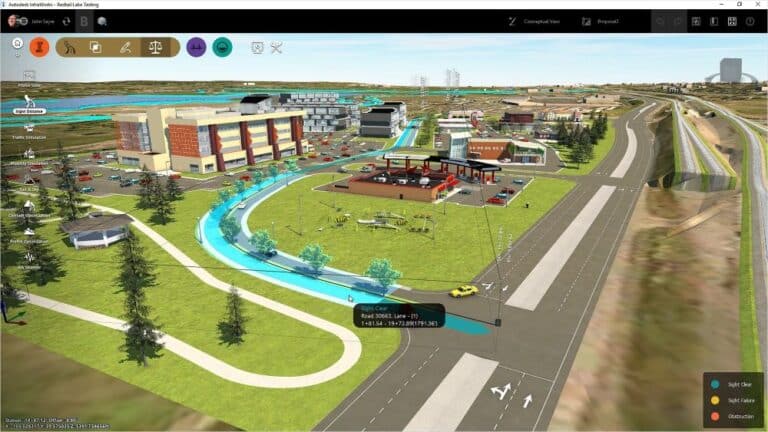
Building Information Modeling (BIM) software has transformed processes for land development engineers by enabling the creation of models that replicate physical locations in 3D.
InfraWorks is a BIM software by Autodesk designed for civil engineers that allows users to create, analyze, and visualize infrastructure projects using 3D models that integrate physical and functional characteristics of real-world objects.
GIS Software
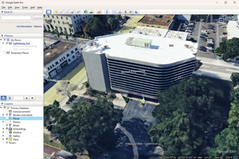
Geographic information systems (GIS) allow users to visualize and interpret geographical data visually, helping them understand and problem-solve relationships, patterns, and trends.
Software like Google Earth Pro gives engineers access to integrated geographical data and street views, helping them better understand the location for land planning, environmental impact studies, and zoning.
Hydrology and Stormwater Management Software
There are several different tools required for tasks in hydrology and stormwater management. Stormwater events need to be modeled over time, and multiple factors dictate which calculations are required for pressurized piping and sizing wet and dry ponds.
EPANET 2.0
Epanet 2.0 models water pressure in pipes, which are typically connected to fire hydrants and buildings. The main reason for modeling pressure within these pipes is to ensure sufficient pressure, measured in Gallons per Day (GPD), even if hydrants and structures use the maximum amount of water in a given event.
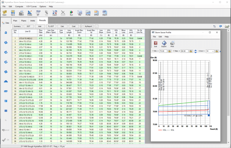
Hydraflow
Hydraflow is a tool within Civil 3D that aids users with an analysis of stormwater routes from a high point to a low point to ensure the water reaches the output, usually based on a 10-year event. This analysis is critical to understanding the maximum stormwater likely to impact a drainage area and avoid overflow (HGL) going above structures. Software like Hydraflow aids land development engineers with critical decisions when flow rates are predicted to push a drainage system past its limit. This problem can often be solved by raising or lowering structures or increasing pipe size.
PONDS
The PONDS 3.3 Application Suite is stormwater drainage calculation software designed for civil engineers in the state of Florida to design, analyze, and create permit-level support documentation for wet and dry retention or detention ponds and to size water quality treatment ponds according to Florida Department of Environmental Protection (FDEP) stormwater rules. In short, software like PONDS 3.3 allows land development engineers to calculate and create supporting documentation for sizing wet or dry ponds.

Document and Calculation Tools
Land development engineers also utilize tools for document creation and cost estimation.
Excel
Excel is integral for land development engineers, enabling accurate cost estimates and calculations for reports. It efficiently handles large datasets for specific scenarios like pond modeling. Data can be shared between AutoDesk’s CAD software and Excel using DataLink so that changes made on one software are reflected in the other.
Word
As with any other business, Microsoft Word is required for land development engineers. Word is mainly used for communication between clients, contractors, and municipalities. It is most often utilized for Respond to Comment (RTC) letters, transmittal letters, and client coordination.
Bluebeam
Bluebeam is design software that helps engineers gain actionable data insights and standardize communication across the project lifecycle.
The software is used for markups and plan reviews in PDF format. Bluebeam offers specific tools to set a uniform scale to be applied across a document or plan and enhanced zoom features that maintain resolution.
Our team at AH Burkett Engineering has mastered each of the essential software tools needed for land development. Our civil engineers are constantly learning and improving to stay up to date and provide the highest quality to our clients’ land development projects. Whatever your next land development project entails, we have you covered.
AH Burkett Engineering is a full-service land development civil engineering firm specializing in construction administration, permitting, rezoning and site design. Please contact us with any questions regarding your land acquisition and development plans.

